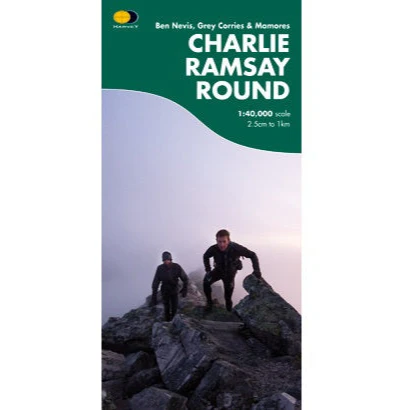
Harvey Map Charlie Ramsay Round
Charlie Ramsay Round: In June 1964 Philip Tranter, son of the author Nigel Tranter, was the first to cover all of these mountains in a single trip, taking in the Mamores, the Grey Corries, the Aonachs, Carn Mor Dearg and Ben Nevis. Could Tranter's round be extended to 24 Munros within 24 hours? At 12 noon on Saturday 8th July 1978, Charlie Ramsay left Glen Nevis Youth Hostel, travelling anticlockwise, heading onto the Mamores. He returned to the youth hostel having completed the circuit in 23h 58m on Sunday 9th July with only 2 minutes to spare. The Charlie Ramsay Round was a reality. 24 Munros within 24 hours: The round's original benchmark.
Detailed, clear and easy to read HARVEY mapping
Waterproof
Light to carry
Can be used with GPS
Ideal for navigation on the fell and also an excellent planning tool
Map size 486x700mm folded to pocket size 243x116mm consists of 4 sections, each providing a strip of map to cover the route and access points. The 1:40,000 map scale gives you a fully detailed map that is a handy size and minimum weight.
Printed on robust, latex impregnated paper
Original: $20.27
-70%$20.27
$6.08Product Information
Product Information
Shipping & Returns
Shipping & Returns
Description
Charlie Ramsay Round: In June 1964 Philip Tranter, son of the author Nigel Tranter, was the first to cover all of these mountains in a single trip, taking in the Mamores, the Grey Corries, the Aonachs, Carn Mor Dearg and Ben Nevis. Could Tranter's round be extended to 24 Munros within 24 hours? At 12 noon on Saturday 8th July 1978, Charlie Ramsay left Glen Nevis Youth Hostel, travelling anticlockwise, heading onto the Mamores. He returned to the youth hostel having completed the circuit in 23h 58m on Sunday 9th July with only 2 minutes to spare. The Charlie Ramsay Round was a reality. 24 Munros within 24 hours: The round's original benchmark.
Detailed, clear and easy to read HARVEY mapping
Waterproof
Light to carry
Can be used with GPS
Ideal for navigation on the fell and also an excellent planning tool
Map size 486x700mm folded to pocket size 243x116mm consists of 4 sections, each providing a strip of map to cover the route and access points. The 1:40,000 map scale gives you a fully detailed map that is a handy size and minimum weight.
Printed on robust, latex impregnated paper